
Old Saybrook: Quiet Wealth on the Sound
Nestled in a quiet nook where the Connecticut River meets Long Island Sound, Old Saybrook embodies that understated Connecticut affluence. It’s one of those towns where the wealth flies under the radar—once home to Katharine Hepburn and a magnet for a well-off crowd. The vibe is a mix: part old-money elite, part shoreline locals whose generational land suddenly skyrocketed in value, leaving them with more riches than they ever expected—or really knew what to do with.
Planning? Not So Much
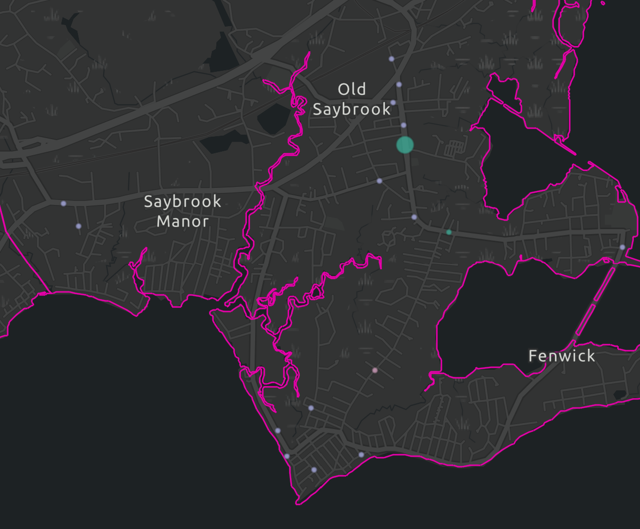
As a beach town, urban planning has never really been Old Saybrook’s strong suit—and it shows. Development hasn’t been a top priority here, and one of the more questionable decisions made by mid-20th-century planners was the creation of Maple Avenue.
Maple Avenue: Old Saybrook’s Most Dangerous Road (In My Opinion)
I call it a weird choice, and I personally consider it the most dangerous road in Old Saybrook.
Now, if we’re going strictly by the numbers using publicly available crash data from the past decade, I-95 technically holds the title—it’s seen multiple fatal crashes in the Old Saybrook area. But when you look at local roads that aren’t highways, only one has had a fatal crash: Maple Avenue.
A Dangerous Design in a Walkable Neighborhood
In my opinion, the way this road was built was careless. Maple Avenue runs through one of Old Saybrook’s wealthiest and most picturesque beach neighborhoods—a place where a lot of elderly residents live, people garden, families stroll to the beach, and walking is a daily ritual. Yet, the road is a wide, double-lined thoroughfare with minimal sidewalks and barely any space for pedestrians. It has the look and function of a high-capacity main road, but it’s in a community where foot traffic should take priority.

Why Wider Streets Make Things Worse
Unsurprisingly, that’s a dangerous combo. One of the most dangerous assumptions baked into American street design is that wider lanes mean safer roads. But recent national research challenges that myth head-on. A study by the Bloomberg American Health Initiative found that 12-foot-wide lanes—standard on many U.S. roads—actually lead to more crashes, especially as speed limits climb above 25 mph. The extra space doesn’t help drivers avoid mistakes—it just encourages them to go faster. In lower-speed, pedestrian-heavy areas like residential neighborhoods, this is a recipe for disaster. Maple Avenue in Old Saybrook is a textbook example: a wide, car-friendly road cutting through a quiet, walkable beach community. Its width invites speed, even though it’s lined with homes, gardens, and people on foot. The result is a street that’s unintentionally dangerous—designed more for throughput than for the safety of the people who actually live there.

Fatal Crash At Maple Street
One example of a fatal pedestrian accident on Maple Street occurred at an intersection that lacked even the most basic safety infrastructure: no sidewalk, no designated crosswalk, no reflective signage, and no street lighting. The crash happened at night—when visibility was already low—and involved an elderly pedestrian and an elderly driver. What makes this especially troubling is that the intersection is in a residential area where people regularly live, walk, and cross the street. The absence of these essential safety features in such a pedestrian-heavy zone likely contributed directly to the tragic outcome.

Crashes Are Symptoms, Not Accidents
The street has seen one pedestrian death and several non-fatal crashes, all clustered in the same general area. And it’s not just Maple Avenue—other streets like Route 154 North follow a similar pattern. It’s more of a systemic design issue across this part of town. The whole neighborhood layout prioritizes cars over people, plain and simple.

A Road That Serves Outsiders More Than Residents
One glaring example of this mindset is how the road is positioned to serve outsiders. Scenic views for out-of-town drivers are given more importance than safety features for beachgoers or accommodations for locals. It’s a beautiful area, but the infrastructure tells you exactly where the priorities lie—and they’re not with the people who actually live there.
Where This All Comes From
The U.S. has long been shaped by a car-first mindset, dating back to the early 20th century when figures like William Phelps Eno pushed for traffic rules that prioritized vehicle speed and flow over pedestrian safety. Streets, once shared by walkers, children, and vendors, were reimagined as spaces meant primarily for cars. This shift wasn’t just about convenience—it carried class implications, favoring wealthy car owners at the expense of working-class pedestrians. Over time, these values were baked into how neighborhoods were designed, including in small towns like Old Saybrook. Maple Avenue is a clear example: a wide, high-speed road cutting through a walkable beach community, yet built with almost no regard for pedestrian safety. It reflects the lingering legacy of a century-old transportation philosophy that still treats people on foot as afterthoughts.
IF YOU’VE BEEN INJURED CONTACT US


Leave a Reply